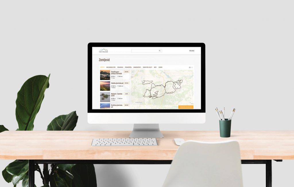
Digitization of cycling routes and footpaths Visit Haloze

The impact of a digitized and centralized tourist offer. We will share with you how we digitized more than 700 km of tourist routes and more than 80 geopoints in Haloze and combined them into a transparent application.

OPENSTREETMAP: >700km  GEO POINTS: 83  REALIZATION: 100%

Visit Haloze case study

The vision of the Visit Haloze organization is to encourage and centralize the tourist and gastronomic offer in the wider Haloz area and to offer the Haloz visitor a digital tool for easier research and organization, thereby improving the issue of a unified offer and representation of local providers, sights and routes. In this case study, we took a closer look at the route digitization process and the development of a web application. 

Digitalizacija kolesarskih poti in pešpoti Visit Haloze

The process of digitalization

We obtained all the routes from the municipal administrations and checked them to ensure that they comply with the standards of tourist routes. Once we had the routes confirmed and verified, we started digitizing the routes in the way of hiking/biking with a navi device and driving a car with a GoPro360.

Web aplication

Digitized routes are freely available on the OpenStreetMap platform and on the app in a format for navigation devices. The most important routes are recorded in an interactive form on the web application using the Mapillary.

Visit Haloze landing

Digitization process

Digitization is becoming a key part of our everyday life every day.  For an organization or company, this means reducing business costs, reducing time for processes that are time-consuming, but still an important part of business and, of course, improving the organization itself. In the case of Visit Haloza, cycling routes, footpaths, attractions, accommodation, winemakers and other providers were part of such processes. In order for the Visit Haloze organization to be able to begin to present itself to the public with a unified tourist offer, it was necessary to develop an online platform where all tourist providers from several municipalities and digitized locations of geo points and mapped cycling and walking paths would be united. All this should be presented in a simple user interface with guides to target all ages of tourists. 

Since this project was carried out during the corona period, we had to find a creative solution for the process of involving virtual tourist visitors, which would also enable an interactive experience for everyone who is just exploring the offer in the future. That’s how we came up with the idea to cover the most beautiful Haloze routes with a camera in 14 days and upload them to the open platform Mapillary for public sharing in future projects.  

Web application development

Before we could start the development of the web application, it was necessary to research the segment of the audience that will use this application. With this, we can more easily adapt the user experience to what the audience is already used to. Since our segment was all people from 15-90, we had to make the app as easy to use as possible. We took the directions from the applications that a person as a tourist would use the most. These were guidelines e.g. Google maps and other competing portals offering excursions. 

After that, we defined all usage scenarios and the visitor’s journey through them. In doing so, we can quickly see where the user will insert himself and what needs to be improved. The rule here is to start with basic functionalities, which can be upgraded later if necessary. After creating the graphic design of the user interface, it is highly desirable to test this interface on a small group of people with usability tests. In this way, we reduce the costs of actual development and have a good user experience developed right from the start. 

The results

Digitization and centralization of information availability is a smart investment for the future for larger organizations that combine several different factors and processes. Of course, any more complex project requires a lot of research and outsourcing to achieve optimal results. In the case of Visit Haloza, the application itself and the digitization of locations and routes would have no effect without the strategic management of the organization and the implementation of various marketing activities. 

 OPENSTREETMAP: > 700 km     GEO POINTS: 83     REALIZATION: 100%

Let's build something successful together